
Major Roads & Interchanges Near Islamabad: 2026 Property Guide
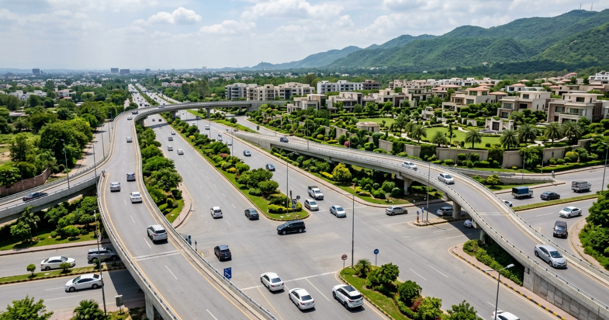
The major roads and interchanges near Islamabad are not a backdrop to property investment they are the investment. Road connectivity is the primary driver of capital appreciation in the twin cities corridor, outranking developer branding, plot size, and even amenity packages. The M-1, M-2, Islamabad Expressway, Margalla Avenue, and Rawalpindi Ring Road are actively reshaping which societies gain value and which stagnate. This guide maps every major corridor and interchange to the societies they serve, the price premiums they generate, and the pre-completion windows that matter most. Whether you are a local buyer comparing housing schemes, an overseas Pakistani orienting remotely before committing capital, or an investor tracking infrastructure-driven appreciation, the framework below gives you a verified, objective basis for your decision. Properties Corner has compiled this guide as Islamabad’s senior real estate and infrastructure resource not a listings aggregator, but a specialist platform built on verified data and on-the-ground market intelligence.
Key Takeaways
- Properties within a 5–10-minute drive of an operational motorway interchange command a verified 15% to 30% price premium over comparable plots reliant on congested feeder roads.
- The Rawalpindi Ring Road (38.3 km) has crossed the 90% completion mark in 2026, fundamentally reshaping access and appreciation for societies along the southern Rawalpindi corridor.
- Margalla Avenue is connecting Islamabad’s northern sectors directly toB-17 Multi Gardens, E-11, and the N-5 GT Road appreciation along this corridor is already pricing in completion.
- The highest capital gains from infrastructure investment are consistently captured before inauguration, not after the pre-completion window is where returns are made.
- Overseas buyers can objectively verify interchange proximity using digital drive-time mapping tools, making road access the single most reliable remote due-diligence variable.
Why Road Connectivity Drives Property Values Near Islamabad
The Interchange Gravity Rule: In the Islamabad-Rawalpindi metropolitan corridor, proximity to an operational motorway interchange is the single strongest predictor of land value appreciation. Residential and commercial parcels located within a 5–10-minute drive of an interchange command a verified 15% to 30% price premium over comparable plots reliant on congested feeder roads.
Road access does several things at once. It compresses commute times. That alone attracts end users willing to pay a premium to live near an interchange. But it also attracts commercial development, petrol stations, retail strips, warehousing, schools which generates further footfall and pushes residential values higher. When a government commits to a new road or interchange, it signals sustained infrastructure investment in that corridor. Resale liquidity follows: plots near motorway access points sell faster and at stronger prices because the buyer pool is broader.
Consider two scenarios. Plot A sits in a peripheral housing scheme with no direct motorway access. The feeder road is narrow, pitted, and adds 40 minutes to the Islamabad commute. Plot B is a comparable plot same size, same price located 10 minutes from a motorway interchange via a well-surfaced road. Over a five-year holding period, Plot B consistently outperforms Plot A on both appreciation rate and resale speed. This is not a theory. It is the documented pattern acrossKohistan Enclave,Faisal Hills, and the societies now sitting along theRawalpindi Ring Roadcorridor.
For overseas Pakistanis evaluating from abroad, this matters more than anything else. Developer claims cannot be independently verified from London or Dubai. Road access can. Open Google Maps, pin the society, measure the drive time to the nearest operational interchange during peak hours. That single data point tells you more about five-year appreciation potential than any brochure.
The sections below map every major corridor in the twin cities network to the societies they serve and the price dynamics they create.
Islamabad’s Road Network: The System Overview
Islamabad’s transportation grid is a connected system not a collection of individual roads. Each motorway feeds into the city from a different directional quadrant, and each interchange anchors a cluster of housing societies that depend on it for connectivity to the capital.
Here is how the system maps directionally:
- M-1 Motorway (Northwest): Connecting Islamabad to Peshawar. The primary corridor for Wah Cantt, Hasan Abdal, and Attock.Brahma Bahtar Interchange is the key access node for this quadrant, serving Kohistan Enclave and surrounding developments approximately 45 km northwest of Zero Point.
- M-2 Motorway (Southeast/South): Connecting Islamabad to Lahore. The highest-traffic motorway in the network.Burhan Interchange is the sole motorway gateway for the Taxila andFaisal Hills cluster, approximately 50 km southeast of central Islamabad.
- Islamabad Expressway (Central Spine): The primary arterial running through the heart of eastern Islamabad, connecting E-11, F-11, B-17, and the capital’s core residential sectors. Feeds directly into DHA Phase 2, Bahria Enclave, and Park View City.
- Srinagar Highway / Kashmir Highway (East-West Arterial): Connects central Islamabad to northern sectors and the New Islamabad International Airport, running roughly east to west. Significant for G and H sector residents and airport-adjacent investment plays.
- Margalla Avenue (Northern Arterial): Running parallel to the Margalla Hills in northern Islamabad. When complete, this corridor connects Sangjani on the N-5 GT Road directly to Islamabad’s central sectors, providing fresh access to B-17 Multi Gardens, Sector E-11, and the northern fringes.
- Rawalpindi Ring Road (Outer Bypass): The 38.3 km bypass connecting the Banth Interchange on GT Road (N-5) to the Thalian Interchange on the M-2 Motorway. Running through southern Rawalpindi, this corridor is transforming access for New City Phase 2, RUDN Enclave, and adjacent schemes.
Each of these corridors represents a directional growth axis. The northwest is anchored by M-1. The southeast by M-2. The central spine by the Expressway. The outer ring by the RRR. Understanding which axis a society sits on is the first step in assessing its long-term appreciation trajectory.
Major Interchanges and the Societies They Serve
Every motorway interchange generates a gravity field a radius within which property values are pulled upward by proximity. The closer a society sits to an operational interchange, the stronger that pull.
Table 1: Major Interchanges Near Islamabad and Rawalpindi
| Interchange | Motorway / Network | Key Societies Served | Property Impact | Guide |
| Brahma Bahtar Interchange | M-1 Motorway | Kohistan Enclave, Wah Cantt | High Primary motorway access point for northwest corridor | Kohistan Enclave guide |
| Burhan Interchange | M-2 Motorway | Faisal Hills, Taxila | High Sole motorway gateway for this cluster | Faisal Hills guide |
| Adiala / Chakri / Thalian Interchanges | Rawalpindi Ring Road | RUDN Enclave, New City Phase 2 | Very High Transforms southern Rawalpindi corridor access | New City Phase 2 guide |
| Margalla Avenue Junction (Sangjani) | Islamabad Northern Arterial | B-17 Multi Gardens, E-11, Sangjani | Very High Direct access to Islamabad core bypassing congested routes | B-17 Multi Gardens guide |
| Expressway Interchanges | Islamabad Expressway | Bahria Town, DHA Phase 2, Park View | High Established high-density, high-liquidity corridor | DHA Islamabad guide |
Browse properties in societies served by Islamabad’s major interchanges on Properties Corner filter by society, plot size, and price range.Explore Society Listings Properties Corner

Brahma Bahtar Interchange: M-1 Motorway and the Northwest Corridor
Which interchange serves Kohistan Enclave and Wah Cantt?
TheBrahma Bahtar Interchange on the M-1 Motorway (Islamabad–Peshawar) is the primary access node for the northwest corridor. It servesKohistan Enclave, the surroundingWah Cantt development zone, and adjacent schemes approximately 45 km northwest of Islamabad’s Zero Point.
For Kohistan Enclave, Brahma Bahtar is not just a convenience it is a structural value driver. Buyers who evaluated this interchange early, before surrounding development matured, captured the strongest appreciation. The pattern is consistent: interchange access precedes commercial activity, commercial activity precedes residential demand, residential demand precedes price appreciation.
Drive-time context for remote buyers: From Brahma Bahtar Interchange, central Islamabad (Zero Point) is approximately 35–45 minutes by motorway under normal traffic conditions. For overseas Pakistanis mapping the geography remotely, place Brahma Bahtar north of Islamabad, past Taxila, on the road toward Peshawar. Kohistan Enclave sits in its direct gravity field.
For a detailed breakdown of Kohistan Enclave’s plot types, pricing, and investment case, see theKohistan Enclave guide on PropertiesCorner.
Burhan Interchange: M-2 Motorway and the Faisal Hills Corridor
Which interchange is nearest to Faisal Hills Taxila?
The Burhan Interchange on the M-2 Motorway (Islamabad–Lahore) is the sole motorway access point for theFaisal Hills and Taxila cluster. It sits approximately 50 km southeast of central Islamabad and functions as the only high-speed gateway for this housing corridor.
Single-interchange dependency creates a specific dynamic. On the demand side, it concentrates connectivity value into one node every buyer or investor targeting Faisal Hills must pass through Burhan. That concentration amplifies the interchange’s price influence. On the risk side, any disruption to the interchange maintenance, congestion, or construction directly affects accessibility. Buyers should factor this into due diligence.
Drive-time context: From Burhan Interchange, Faisal Hills is approximately 10–15 minutes by feeder road. The drive to Islamabad’s central sectors from Burhan runs approximately 45–55 minutes on the M-2 under normal conditions. For overseas buyers, place Burhan south-southeast of Islamabad, on the Lahore motorway Faisal Hills sits in the direct catchment.
Faisal Hills via Burhan is a mid-tier interchange-adjacent investment with strong structural demand, backed by its position as the only motorway-connected housing cluster in the Taxila radius.
For verified listings, payment plans, and infrastructure updates, visit theFaisal Hills guide on PropertiesCorner.
Rawalpindi Ring Road: The 38.3 km Corridor Reshaping Southern Rawalpindi
How does Rawalpindi Ring Road affect property values?
The Rawalpindi Ring Road (RRR) is a 38.3 km bypass connecting the Banth Interchange on GT Road (N-5) in the east to the Thalian Interchange on the M-2 Motorway in the west. As of 2026, construction has crossed the 90% completion mark, making this the most consequential active infrastructure development for Rawalpindi property values near Islamabad.
⚠️THE PRE-INAUGURATION APPRECIATION WINDOW:
Investors evaluating infrastructure corridors must distinguish between pre-completion spec pricing and post-inauguration liquidity. The highest capital gains are consistently captured before a road project opens to public traffic. Once an interchange or ring road is inaugurated, the market transitions from speculative appreciation to end-user rental and commercial yield growth.
The RRR’s key interchanges Banth, Chak Beli Khan, Adiala Road, Chakri Road, and Thalian each anchor a cluster of residential and commercial development. Societies directly in the uplift radius includeNew City Phase 2,RUDN Enclave, and adjacent schemes along the southern Rawalpindi corridor.
What the Ring Road does to property values:
- It compresses travel time from southern Rawalpindi to the New Islamabad International Airport (northeast) and to the M-2 (southwest), removing the bottleneck of Rawalpindi’s congested central grid.
- It opens the 500-meter corridor buffer along the alignment to commercial development logistics hubs, petrol stations, retail strips which generates secondary demand for adjacent residential plots.
- It signals sustained government infrastructure investment in the southern corridor, which improves buyer confidence and resale liquidity.
Land rates along the RRR corridor have moved measurably since the project’s announcement. Buyers entering post-inauguration will pay the full post-completion premium. The pre-completion window which is closing is where infrastructure-driven returns are captured.
For a full breakdown of New City Phase 2’s plot types and RRR proximity, visit theNew City Phase 2 guide on PropertiesCorner.
Speak to a PropertiesCorner specialist to identify which societies will benefit most from the Rawalpindi Ring Road completion and other upcoming road projects in 2026.Book an Infrastructure Investment Review PropertiesCorner
Margalla Avenue: Islamabad’s Northern Corridor Under Construction
What is Margalla Avenue Islamabad and which areas does it connect?
Margalla Avenue is a northern arterial road running parallel to the Margalla Hills, connecting the Sangjani node on the N-5 GT Road directly to Islamabad’s central sectors specifically B-17 Multi Gardens, Sector E-11, and Sector D-12. For overseas buyers, orient it as follows: Margalla Avenue runs along the northern edge of Islamabad, with the Margalla Hills to its north and the capital’s residential sectors to its south.
Margalla Avenue Islamabad Road Project B-17 Connectivity 2026
When complete, Margalla Avenue will giveB-17 Multi Gardens and northern sector residents a direct, high-capacity route into central Islamabad, bypassing the congested feeder roads that currently add significant commute time. That accessibility gap is currently priced into northern sector land rates and appreciation is already moving as completion approaches.
What this means for buyers:
Appreciation around Margalla Avenue is pricing in completion now. Buyers entering the B-17 corridor today are buying infrastructure value that has not yet been fully realized. Once the road opens to traffic, the speculative premium converts to end-user demand and commercial development at which point entry prices will reflect the full post-completion reality.
For societies in the B-17 corridor, Margalla Avenue is the single biggest structural change to their accessibility profile in a generation. It is not an incremental improvement it is a connectivity reclassification.
For verified B-17 Multi Gardens listings and infrastructure timeline updates, visit theB-17 Multi Gardens guide on PropertiesCorner.
How Motorway Interchange Proximity Affects Property Prices: The Data
The 15% to 30% price premium for interchange-adjacent plots is not an estimate. It is a pattern documented across the twin cities market through comparative listing analysis. Here is how it breaks down in practice.
Major Roads and Interchanges Near Islamabad Property Guide 2026
Direct Access vs. Secondary Access: A Comparison
Take two comparable plots in the Taxila radius similar size, similar development stage. Plot A sits in a society with a direct feeder road to the Burhan Interchange, approximately 10 minutes from the M-2. Plot B sits in an adjacent society with no direct interchange access the commute to Islamabad requires navigating GT Road through Taxila’s congested inner grid.
PropertiesCorner’s listing data consistently shows Plot A commanding a measurable premium over Plot B, reflecting the market’s pricing of commute time compression, commercial footprint proximity, and resale liquidity. The gap widens as end users, not just investors enter the market and prioritize daily commute viability.
Pre- vs. Post-Announcement Value Shifts: The RRR Corridor
The Rawalpindi Ring Road provides the clearest local data point for infrastructure-driven appreciation. Land rates along the Adiala Road and Chakri Road interchange zones moved significantly between the RRR’s initial announcement and the 2026 construction milestone markers. Buyers who entered the corridor on the announcement before construction had physically altered road access captured the steepest appreciation curve. As the 90% completion mark was reached in 2026, asking prices along the corridor reflected a compressed pre-inauguration premium, with post-completion end-user pricing expected to follow.
For overseas buyers: You do not need a site visit to verify interchange proximity. Open Google Maps. Pin the society. Measure drive time not distance to the nearest operational interchange during peak commute hours (7:30–9:30 AM local time). That number is your primary due-diligence data point for long-term value assessment.
Islamabad real estate rewards buyers who understand infrastructure. The societies that appreciate fastest are not always the most marketed they are the most connected.
Nearest Motorway Interchange: How to Identify Yours Before You Buy
480 people search for “nearest motorway interchange” every month in this market. That search intent has a clear meaning: buyers want to verify connectivity before committing. Here is a step-by-step process for doing exactly that.
Rawalpindi Ring Road Property Value Impact 2026
Step 1: Pin the society’s GPS coordinates.
Use the society’s main gate or development office as your anchor point. Most major housing schemes are locatable on Google Maps by name.
Step 2: Map drive time, not distance.
Distance is irrelevant. A 5 km stretch of poorly surfaced feeder road can take longer than a 15 km motorway run. Measure drive time during peak commuter hours 7:30 AM to 9:30 AM on a weekday to the nearest interchange.
Step 3: Verify operational vs. planned interchange status.
An under-construction interchange carries both opportunity and risk. If the interchange is operational, the connectivity benefit is current and priced in. If it is planned, you are buying speculative access higher upside, higher risk. Confirm status before interpreting drive-time data.
Step 4: Audit the feeder road between the society and the interchange.
An interchange 8 minutes away via a damaged, single-lane feeder road is functionally further than a clean, dual-lane 12-minute route. Road width, surfacing quality, and flood vulnerability all affect functional commute time.
Step 5: Cross-reference with PropertiesCorner price data.
Once you have the drive-time figure and road quality assessment, compare the asking prices in that society with comparable societies at different interchange distances. PropertiesCorner’s listings allow filtering by society, plot size, and price range to calibrate whether the interchange premium is already fully priced in or still represents value.
Upcoming changes to watch: The Margalla Avenue completion and the Rawalpindi Ring Road inauguration are the two infrastructure events that will most significantly redraw interchange access maps across multiple societies in 2025–2026. Societies currently priced without these corridors will reprice when they open. Buyers who act ahead of that repricing capture the widest margin.
Societies along the Islamabad Ring Road corridor including RUDN Enclave, New City Phase 2, and developments adjacent to the Chakri and Adiala interchanges are among the most actively tracked on PropertiesCorner for infrastructure-driven appreciation signals.
The Right Society on the Right Corridor
Road connectivity is not one factor among many. It is the factor. Every other variable amenities, developer brand, plot size is secondary to the question of how quickly and reliably a resident can reach Islamabad’s core from their front gate.
Major Roads & Interchanges are driving the next wave of real estate growth across the Islamabad–Rawalpindi region. The framework is clear: M-1 and Brahma Bahtar anchor the northwest corridor, while M-2 and Burhan support the Faisal Hills and Taxila cluster. Meanwhile, the Rawalpindi Ring Road is reshaping the southern Rawalpindi corridor in real time, with pre-inauguration appreciation already well underway. Margalla Avenue is reclassifying the accessibility profile of B-17 and the northern sectors, and that repricing is happening now not after the road opens.
The pre-completion window is the window. Societies along upcoming road corridors are pricing in future connectivity today. Once an interchange opens or a ring road is inaugurated, the entry point has already moved. The infrastructure-driven return window is captured by buyers who act on verified data before the market fully prices in completion.
For overseas buyers: the interchange access framework in this guide is objective and verifiable from anywhere in the world. You do not need a site visit to apply it. You need a Google Maps drive-time figure, a verified listing comparison, and a PropertiesCorner specialist who understands how infrastructure maps to price in each corridor.
Contact PropertiesCorner today to identify the right society on the right interchange for your budget and investment horizon.
Explore Verified Society Listings — PropertiesCorner Society Listings Page
Book an Infrastructure Investment Review — PropertiesCorner Consultation Page
Frequently Asked Questions
Which interchange is nearest to Faisal Hills Taxila?
The Burhan Interchange on the M-2 Motorway (Islamabad–Lahore) is the nearest and only motorway access point for Faisal Hills and the wider Taxila housing cluster. From Burhan, Faisal Hills is approximately 10–15 minutes by feeder road. See theFaisal Hills guide for verified listings and current pricing.
Which interchange serves Kohistan Enclave and Wah Cantt?
Brahma Bahtar Interchange on the M-1 Motorway (Islamabad–Peshawar) is the primary access node for Kohistan Enclave and the Wah Cantt development corridor. It sits approximately 45 km northwest of Zero Point, making it the defining connectivity anchor for this housing cluster. Visit theKohistan Enclave guide for full details.
How does Rawalpindi Ring Road affect property values?
The Rawalpindi Ring Road compresses travel time from southern Rawalpindi to both the New Islamabad International Airport and the M-2 Motorway, bypassing the congested central city grid. As of 2026, the 38.3 km corridor is approximately 90% complete, and land rates along the Adiala Road and Chakri Road interchange zones have already moved in response to construction milestones. Post-inauguration, the corridor is expected to attract commercial development that will drive further residential appreciation.
What is Margalla Avenue Islamabad and which areas does it connect?
Margalla Avenue is a northern arterial road running parallel to the Margalla Hills in northern Islamabad. It connects the Sangjani node on the N-5 GT Road to Islamabad’s central sectors, directly serving B-17 Multi Gardens, Sector E-11, and Sector D-12. When complete, it will significantly reduce commute times for northern sector residents and is currently driving pre-completion appreciation in the B-17 corridor.
Which societies are along the Islamabad Ring Road?
The primary societies in the Rawalpindi Ring Road corridor include RUDN Enclave, New City Phase 2, and developments adjacent to the Chakri and Adiala interchanges along the southern Rawalpindi alignment. See theNew City Phase 2 guide for PropertiesCorner’s verified listings in this corridor.
How does motorway interchange proximity affect property prices in Islamabad?
Plots within a 5–10-minute drive of an operational motorway interchange command a documented 15% to 30% price premium over comparable plots lacking direct interchange access. The premium reflects commute time compression, proximity to commercial development, and stronger resale liquidity all of which are driven by verified connectivity rather than developer marketing.
What upcoming road projects will increase property values near Islamabad?
The three most consequential active projects are the Rawalpindi Ring Road completion (38.3 km, 90% complete as of 2026), Margalla Avenue’s northern corridor expansion connecting Sangjani to central Islamabad sectors, and the Kachehry Chowk upgrade improving central Rawalpindi arterial access. Each of these represents a pre-completion appreciation window that is actively closing.
Which is the best society near a motorway interchange in Islamabad?
The answer depends on your budget and investment horizon. Faisal Hills via Burhan Interchange (M-2) represents the mid-tier case with strong end-user demand. Kohistan Enclave via Brahma Bahtar (M-1) offers northwest corridor exposure with verified NOC approval. DHA Phase 2 via the Islamabad Expressway anchors the premium, high-liquidity end of the market. PropertiesCorner’s verified listings across all three allow direct comparison.


